
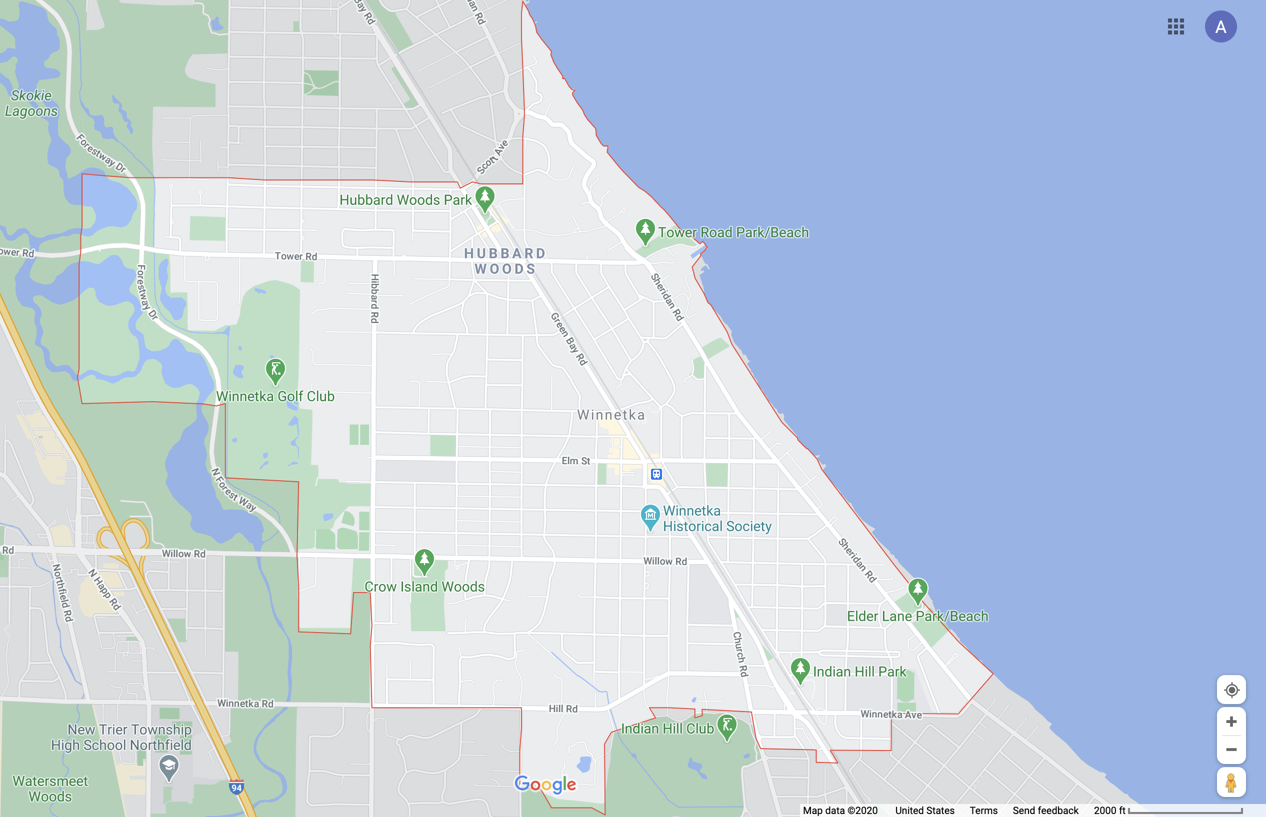
Indian Hill Park is one block from the southern boundary of Winnetka, Illinois. It is hard to differentiate Winnetka as either a town or a neighborhood, as it is a small town but is seamlessly connected to neighboring towns with no real barriers – however, the southwestern boundary of the town is delineated by Hill Road, which is a street with more traffic than streets closer to the center of the town. Hill Road is then arguably an arterial street as described by Perry (1929). Tower Road to the north and Sheridan Road also serve as arterial streets with heavier traffic and fewer pedestrians, as well as Green Bay Road running through Winnetka.
The train station near Indian Hill Park is part of Metra Union-Pacific North train line serves as a transportation corridor as described by Plater-Zyberk (2013), though it is not a difficult one to cross on foot or by car. The train line runs parallel to Green Bay Road at this location. Going north on Green Bay Road from Indian Hill park, there is the center of Winnetka, with the village hall, post office, library, community center, and a series of stores and restaurants. Due to its relative distance from the center of the town and its periphery to residential streets and a nearby high school, Indian Hill Park is most accessible to people who live nearby and those who have access to the trail running parallel to the Metra train line, as well as high school students who get to school by taking a bus on Green Bay Road from neighboring towns. It is not immediately accessible by foot if one is in the center district of Winnetka – in fact, many of Winnetka’s parks are surrounded by residential blocks and are not close to the center district but are on arterial streets. The Hubbard Woods shopping district is near the northern boundary of Winnetka, at the intersection of Tower Road and Green Bay Road and serves the town of Glencoe to the north of Winnetka, creating a commercial edge to both towns (Plater-Zyberk 2013). These shopping districts are accessible by foot to the immediate residential blocks and also the bus route along Green Bay Road as well. but seem to be most frequently accessed by people with cars.
Lynch (1960) describes Lake Michigan as a gigantic edge, which is relevant in my map, as Indian Hill park is less than a mile from the lakefront. The western boundary of Winnetka is a forest preserve called the Skokie Lagoons. The Lagoons also serve as a boundary, as it is difficult to cross going east or west without driving on heavy-traffic roads and the Edens Expressway runs north-south on its western side. The Lagoons are also a green corridor (Plater-Zyberk 2013), and are a buffer between Winnetka and the highway (the long-range transportation corridor with the heaviest traffic in the area).