In 1.2, I originally evaluated a boardwalk, for this small Beach town my family vacations in, Bethany Beach, DE. Specifically, I am contextualizing the Boardwalk and Downtown area into its surrounding Neighborhood.
BORDERS:
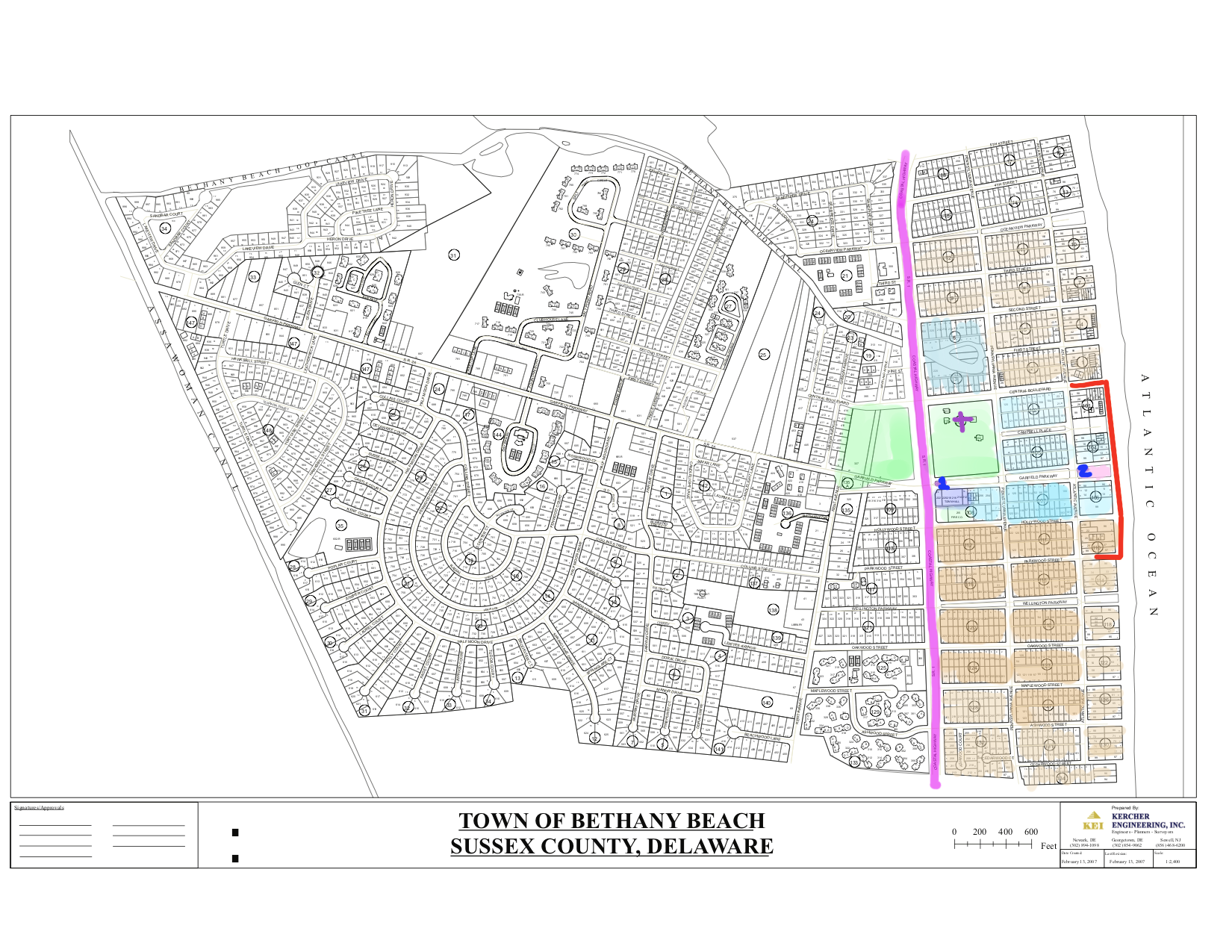
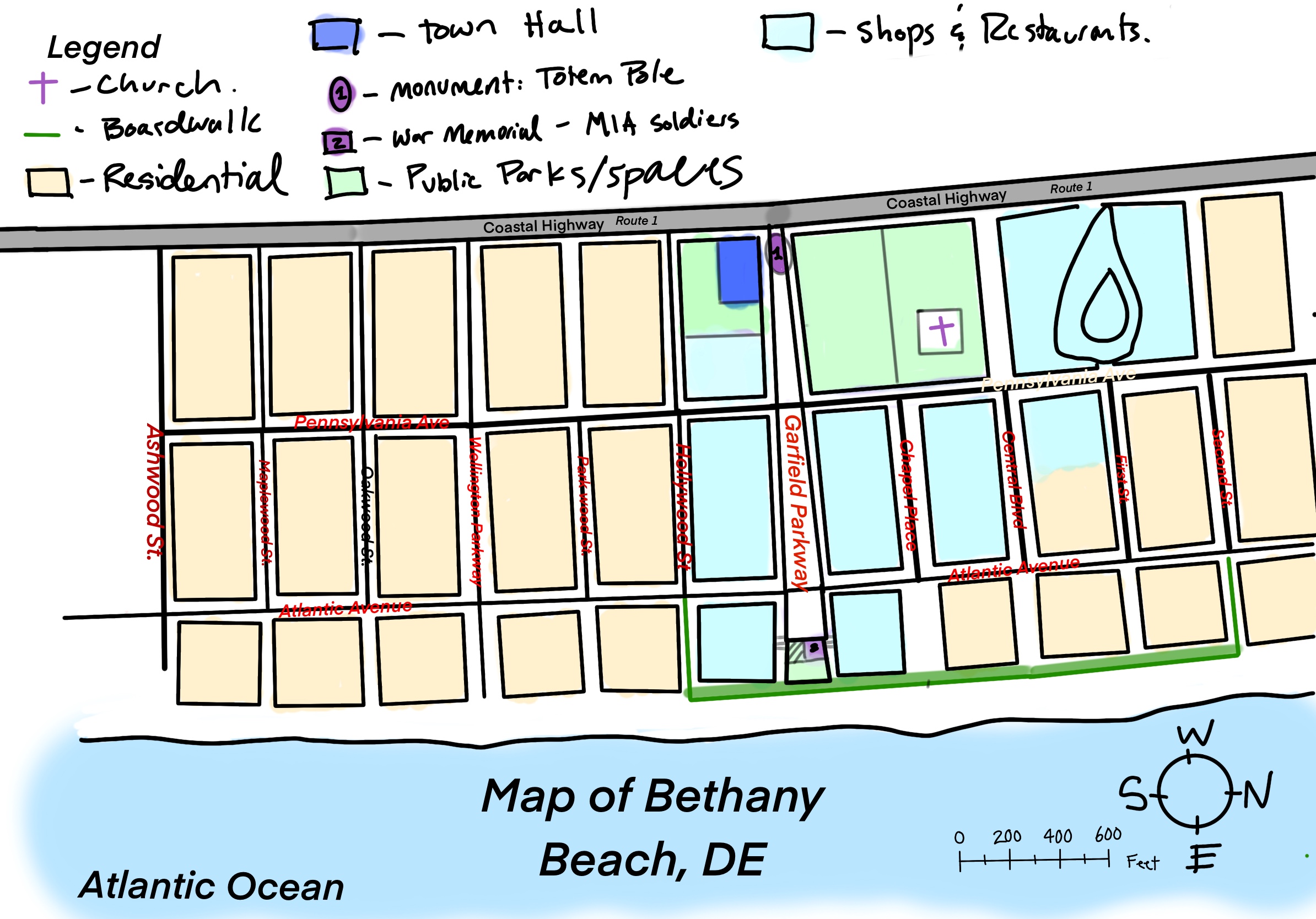
There are two maps provided: The first is of the official town map provided from the town’s web page, but I highlighted the area that is the true “neighborhood” of downtown Bethany Beach, as it has more distinct edges, that is the Coastal Highway. Additionally, the types of homes that exist in that area are different from the homes across from the Highway, making the distinction between Downtown Area and the surrounding residential neighborhoods. The houses East of the Coastal Highway are more like apartment complexes and are stood up on large stilts to protect from flooding; unlike the houses west of the Highway, which mirror houses typical of the suburban myth (cookie cutter, grass lawns, white fences, etc.), and are not lifted from the ground since they are uphill from the downtown area. I have also provided a redrawn map of the zoomed into the Downtown Neighborhood, from Ashwood St. to Second St. (to better see the street names and monuments). The Housing south of Ashwood St. belongs to the private community called Sea Colony, which creates a Southern edge to the neighborhood of Downtown Bethany. The Border to the North is less defined, but small shops creep along the Highway North of Second Street, and the residential buildings slowly thin out.
Monuments are also indicators of a Border. Facing the West, looking out onto Coastal Highway, is a large Totem Pole that is placed on the Median of Garfield Parkway, which is highlighted in purple on the map. This totem pole is an icon of the Town, but it also is a visual border for the town. It is a contrast to the plain Highway, and since it is a symbol of the town, people who see it recognize it as a marker of the beginning of Bethany.
SOCIAL CENTERS:
With the Borders of Downtown Bethany established, The physical social structure of Downtown Bethany can be evaluated. Bethany is set up in columns that are oriented from west to east, with a social column inserted in the middle, sandwiched by thicker columns of residential areas made of privately-owned homes. This Social column lies along Garfield Parkway, where the shops and restaurants line the street leading up to the Boardwalk. There are layers to concentration of “socialization” within this column, with the boardwalk (closer to the ocean) being the most social and area. This is because the social activities in Bethany cater to beach goers in the summertime. The social column along Garfield Parkway serves as a barrier between the residential areas, saving the homeowners privacy. Additionally, it is important to note that the beach goers are not always residents of the town, and this is made clear by the proximity of the highway to the town; It gives people who are not residences of Bethany an easy access to the beach and the Boardwalk, since Garfield Parkway is connected to the Highway, and shoots straight back to the Boardwalk. Social activities more appropriate for residences are placed on the opposite side of Garfield Parkway, like public parks the residences pay for through taxes, and Churches that they belong to are all collected in the same area close to the highway, and away from the Boardwalk.