
 The map I’ve produced in Assignment 1.2 is about the residential district at which I currently live in. Though the overall city planning and construction between the U.S. cities and the city where I reside in are not quite similar. However, as reviewing the composition of the neighborhood of this residential district, it follows the general pattern of a typical neighborhood unit as described in The Neighborhood Unit by Clarence Perry (1929) and in the first chapter of Charter of the New Urbanism: Congress for the New Urbanism. (Calthorpe, 2013)
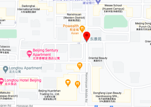
This residential district is located on the Nanxinyuan Middle street, which is around 1.5 kilometers long from north to south. Though the street is not so wide, it has two one-way lanes going opposite directions, and each side also has lanes for bicycles and pedestrians. There are in total three different residential districts located on the two sides of the street, while the two districts on the west side of the street are smaller than the one on the east side. Due to the lack of parking lots inside each of the residential districts, car owners living around would choose to park on the bicycle lanes for their convenience, which narrows the overall width of the street and caused traffic jams and danger. To fix such issue, governors in charge of this area labeled the bicycle lanes with the sign of “NO PARKING”, and installed monitoring cameras to track the behaviors of people around. The key problem, non-enough parking space, was indeed not fixed. Such actions cleared up the street, but at the same time irritated car owners and raised more complains. However, it adjusted the uses of the road that provide equality to pedestrians, the bicycles and also the automobiles (Cathorpe, 2013).
As walking out from Gate 1 of the residential district illustrated on the map, people enter the center of the neighborhood. The center is determined not only due to it is the common area shared by all the three residential districts. More importantly, it serves as the essential commercial area that provides the basic life needs for residents living here. In this center area, there are two different supermarkets. Each of them is within a 5-minute walking distance to the residential area on either side of this street. Near the supermarkets are various restaurants and cafes. Barbershop and a beauty salon can also be found in the neighborhood. There are also entertaining spaces such as karaoke, a pocket billiards bar, chess and card room, activity room for senior residents, etc. At the corner of the street, there is a private clinic that is able to give basic healthcare to the community. Besides, as indicated in the Perry 1929 paper, neighborhood units should provide educational spaces, which is one point that parents and families with children care about. Education agencies and schools, including one kindergarten and one middle school are located on this street. There are also playgrounds and one children activity center that are within the 15-minute walking distance from the neighborhood unit.
In summary, the neighborhood unit of the residential district depicted in the map meet the basic needs of people and their families living there. The well and complete construction of the neighborhood will increase the live quality and happiness of the residents.