
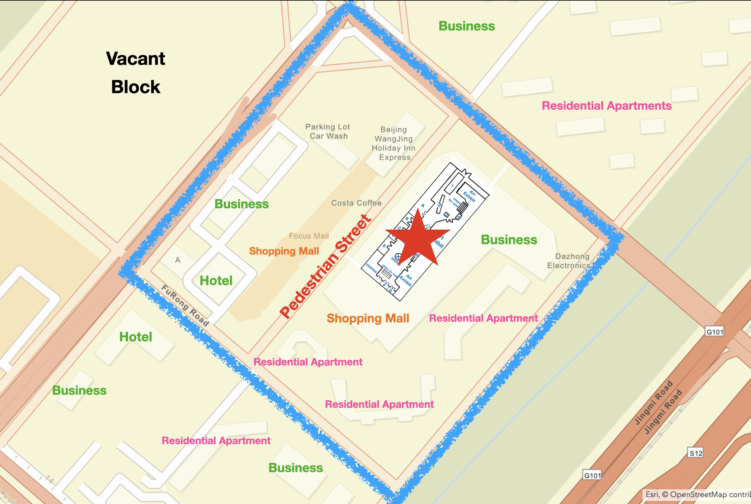
Map 3. Plan of the Blocks of the Plaza (www.arcgis.com)
To understand the role of this sunken plaza towards its neighborhood, I firstly put it into the block to which it belongs (see map 3). This square block has a total area of 35 acres with the length of a quarter mile. It includes a central pedestrian street, two shopping malls, some office buildings for business, two hotels, and three residential apartments in the south. Located in the south of the pedestrian street, the sunken plaza is in the middle of Wangjing Garden as aforementioned, enclosed by buildings from four sides. The surrounding buildings are the combination of office upstairs and commercial spaces at the first floor and underground. Although corridors passing through the buildings connect the pedestrian street with Wangjing Garden and the sunken plaza, this plaza is still hard for new visitors to find. On the other hand, local residents come here more frequently, since they prefer this hidden place with fountains and opening spaces. As no automobile road exists in this block, the pedestrian and this plaza are more favorable by parents and their little children who require a safe place to spend time in.
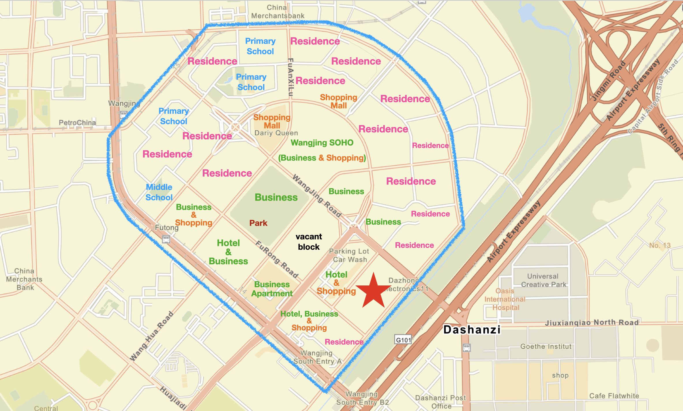
Map 4. Plan of the Neighborhood Unit
of the Plaza (www.arcgis.com)
Then, I define a neighborhood unit for this sunken plaza, by circling an area within blue lines (see map 4). This neighborhood unit contains 16 main blocks, and I view Wangjing Soho as its center. In this way, the distance from its center to each edge is about half a mile. Compared to Plater-Zyberk’s definition wherein “the ideal size of a neighborhood is a quarter mile from center to edge”, this neighborhood is double wider with a quadruple larger area(112). Accordingly, due to the large scale of the block, residents’ motion inside the neighborhood is mainly supported by automobiles and bicycles. Enclosing this neighborhood, the edged roads form a ring and “serve as main traffic arteries” for the entire Wangjing District (Perry 491). Inside of the southern edge, the block including the sunken plaza is located, surrounded by residential zones and business areas. In spite of its location near the edge, this block still connects to main roads from each side. It can be viewed as a node where local people gather at. Nearby people come here by foot, and others can arrive by cars or subways. The block sets an artificial intelligence system for parking lots to diffuse the traffic jam. Once the parking space here is full, this system helps arriving cars to find a space in neighboring blocks.