A look into Wellfleet, M.A.
When looking to place Wellfleet’s central green in a broader context, one has to look at nearly half the town. Fortunately, the town is rather small. It is bordered on two sides by the sea, and its land borders are relatively narrow. It is barely five miles at its widest, and a large percent of the ton’s territory is fully or partially underwater. Access to the town is limited, and has changed over the years. At first the harbor was the main point of access. Then came the railroad, and eventually Route 6, which is now the main artery of the town. It is quite similar physically to other outer Cape Cod towns, a fact that becomes even more apparent when you barely notice the border between them. However, Wellfleet has its own unique history that has shaped it, and continues to do so.
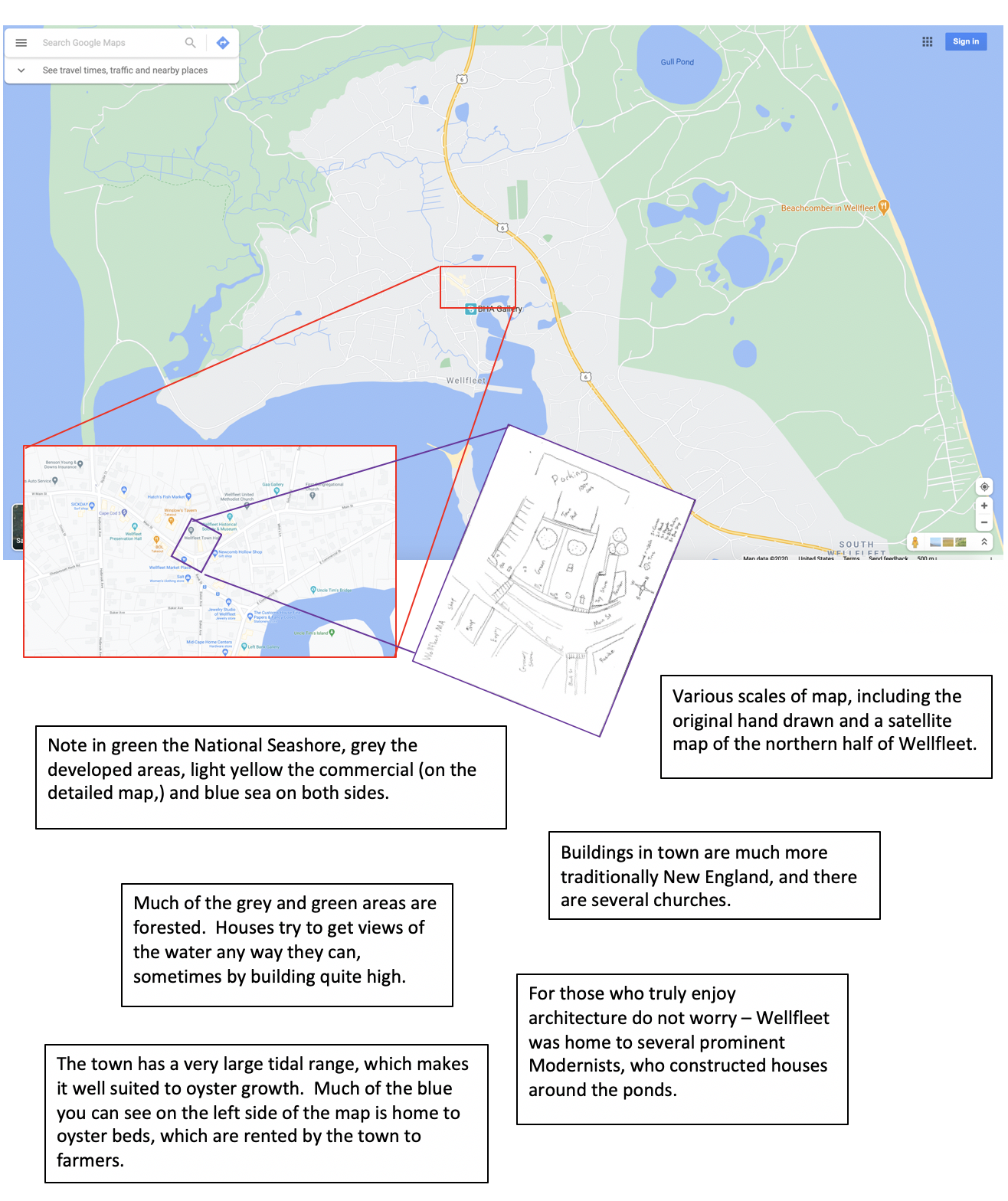
Once a major fishing and shellfish town, Wellfleet today is more known for its tourism. Every summer the population triples, as tourists flood in to see the natural beauty, preserved by the National Seashore. This can be seen on the map in green. Though it takes up a significant percent of Wellfleet’s land, the tourism it brings, and undeveloped charm it preserves, has been a great benefit to the town. Wellfleet is still famous for its oysters, a fact that is celebrated every year at Oysetfest, but much of its revenue comes in during the summer months.
Wellfleet itself is divided into two halves, which is reflected by its two zip codes. South Wellfleet is part of the township, but has its own small commercial area. It is barely large enough to attract traffic, but still manages to scrape by due to a delicious French bakery. The true “town” is Wellfleet proper, which I partially described in the last assignment. Much like the township, the main town is divided in two. All traffic, like much of the cape, flows in from Route 6, but is then divided to either the town green or the harbor. Looking at the map provided, the town green, or “Central Historic District” (CHD) is in red. The main commercial strip along Main Street is where much of the town’s summer shopping is done. Alongside the grocery store, toy store, and town hall, there are also many clothing boutiques. Most of these stores close in the winter, with the exception of the liquor and grocery store, but more on winterization later. There are also several art galleries, which stretch down Bank Street and towards the harbor for ¼ of a mile. However, there they stop. The placement of a lumber yard, and the distance to the harbor, creates a rather odd gap in the townscape. Now we will look at the other hub of the town – the harbor.
Wellfleet harbor is not a very large place. On the map it can be spotted by the large jetty. Yet despite its small size it attracts vast numbers of tourists because of several restaurants and a fantastic setting. If the CHD is the picturesque New England town, with its churches and clapboard houses, the harbor is the perfect small time fishing port. There are just enough rigged boats to create the vital sights and sounds, but not enough to produce the smells. However, its distinct separation from the CHD means a lack of walkability. One either drives there (not an issue given the car dependency of all the cape – Route 6 truly is an artery) or lives nearby. With the CHD there is a bus, and many people rent houses in the surrounding area, but not the harbor. It stands alone, facing the sea.
Like all tourist locations, the very thing that keeps the town alive is also its biggest source of trouble. Tourists typically rent houses over the summer for 1-2 week stays, bringing in money in the form of taxes and beach access stickers. Again, without the beaches the town would be just another run down New England location. But their presence also drives up home prices, creates major traffic congestion, and infuriates the year-rounders. Their presence sometimes destroys local neighborhoods, as they leave houses empty for the winter. Their massive cars do damage to the roads, and everything they touch they destroy. Local shops are replaced with tourist boutiques. The average Wellfleetian makes far less than the tourist, and cannot afford to spend $200 on a cashmere tunic. But without the tourists the locals would only sink further into poverty. During the off season the town is nearly dead. It is one of the most beautiful places to be during the winter, yet often the most depressing. The galleries, restaurants, and stores close. The harbor quiets. In fact, one of the only industries that continues at full speed is that which made the town famous – oysters. Oyster farmers make very little, and their work is excruciating. But they are the few that can be seen in the winter. The town may be near dead, but every once in a while their trucks roll down main street and stop for food. All the grey zone of the map is near empty. The beaches are cold, the small houses have their shades battened, but deep in the woods, along the edges of Route 6, the locals live on.
Wellfleet is, in many ways, two towns. North and south. Harbor and CHD. Winter and summer. Local and tourist. The split is sometimes difficult. Infrastructure needs to support both, regulations may not apply equally. But the truth is that neither could survive without the other. The CHD, for all its tourist trappings and historically preserved buildings, needs the harbor and beaches. The tourists that are there for the beaches need to be bled of their cash. It is a delicate balance that nobody is happy with, but that keeps the town going. Covid threw a wrench into the cycle, but it will continue. The tourists will cause problems, the locals will gripe and struggle, but they all survive. And every day they go about their lives, traveling up and down Route 6.