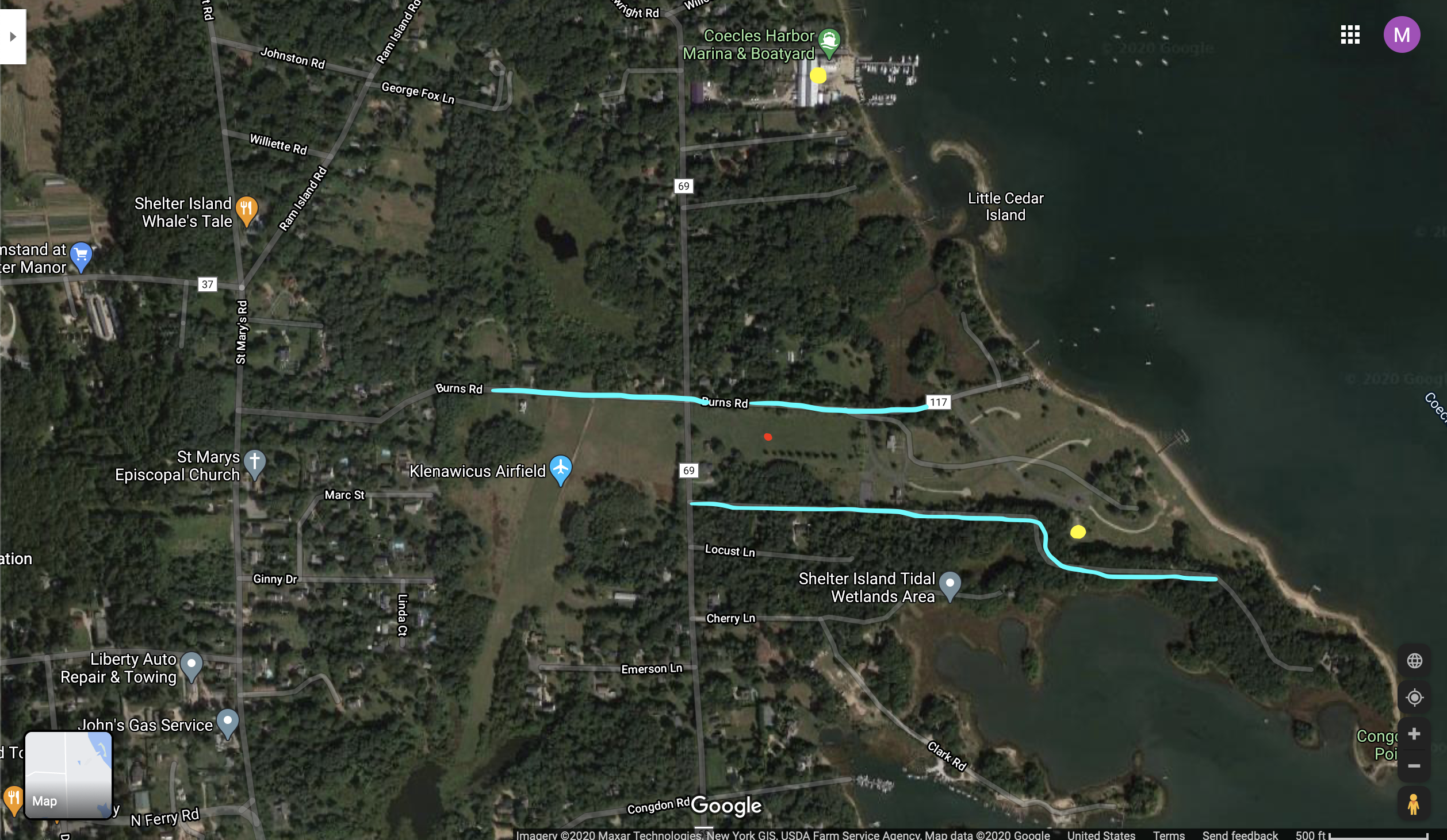
The field is located in a fairly rural area on Shelter Island. For this reason, it is difficult to label this land as being “in the center” or “on the edge”. Based on Lynch’s classifications, the roads are the paths for my chosen public space. On the north side, Burns Road runs laterally while North Cartwright Road runs longitudinally. The field is located on the corner of Burns Road and North Cartwright Road. To the left of the field, there is an international landing strip called Klenawicus Airfield. This airfield exists parallel to North Cartwright Road. Also, based on Lynch’s explanations, the landing strip is the edge for the west side of my space. On the right side toward the harbor, there are land parcels that are currently being built into five new mansions. Before this development, this land was used for religious retreats and ceremonies. A small church used to exist called St. Gabriel’s Church. When the land was being sold, the buyers made a promise to the Shelter Island residents that they would not harm the church. However, after the buyer purchased the land, they demolished St. Gabriel’s Church. The edge on the east side is the beach on Coecles Harbor. The southern edge for my location would be the wooded area lining the southern side of the field.
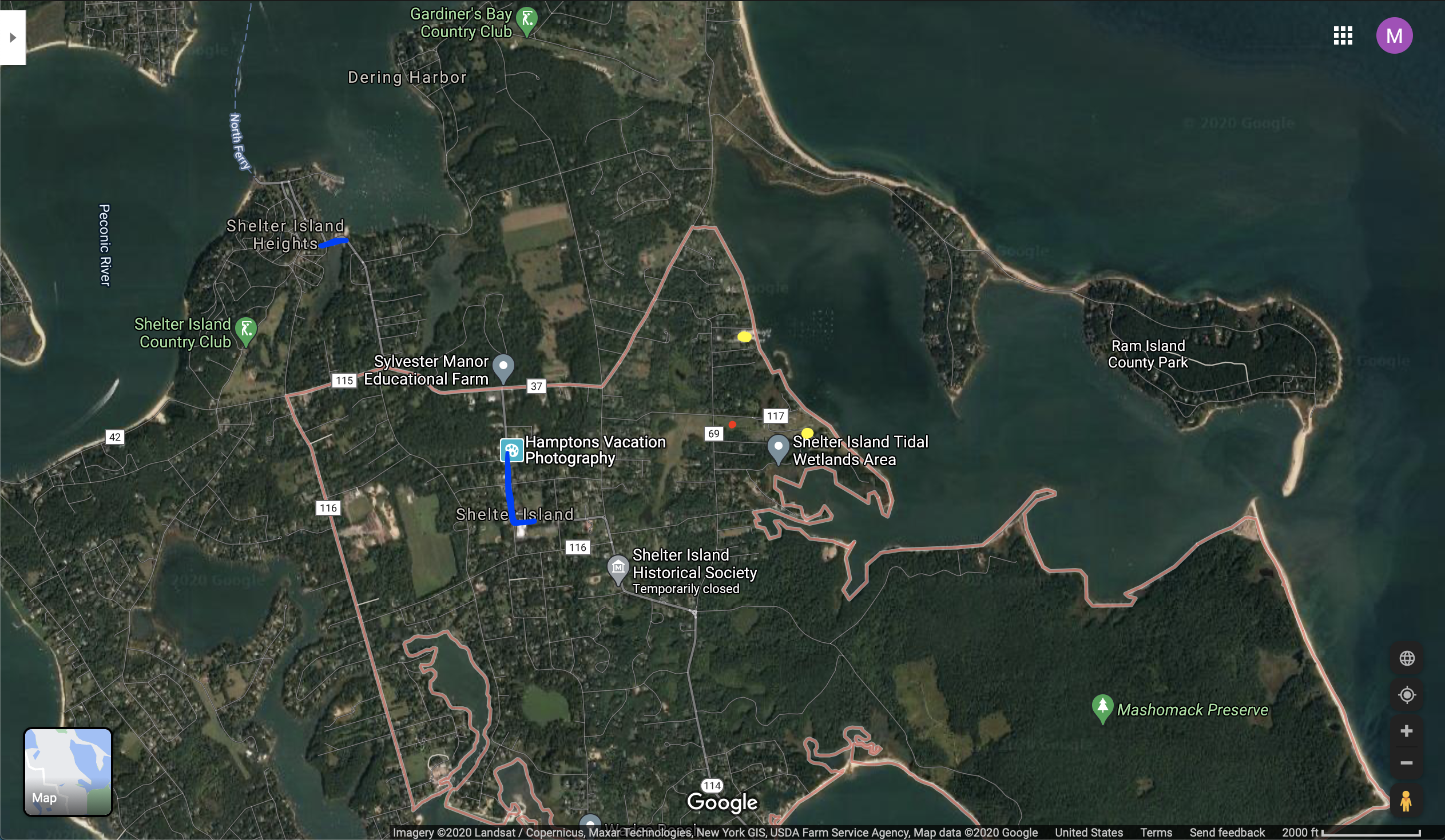
In the second map, I captured a larger area of Shelter Island. I marked the commercial spaces in dark blue. The field, the island beaches, and the two shopping areas are easily accessible from anywhere on the island. Shelter Island is not a big island, and many people prefer to bike or walk to their intended destinations. By Lynch’s definition of a node, I would not label my space as a node because it is not a junction of paths where people congregate. My example of a node on Shelter Island is Coecles Harbor (indicated on the map with a yellow dot). Coecles Harbor is a place where people cross paths during their adventures. There is also a snack bar that attracts people to the location as a meetup spot. On the map, there is also a yellow dot in the southeast corner. It represents the old location of St. Gabriel’s Church. The church and outdoor green space was a node for the community of practicing Catholics on the island.
After going through the recent readings, I have especially noticed the socioeconomic divide on the island. Since almost everyone attends Chicken Barbeque, it is easy to see the difference in economic status simply by looking at the different car makes and models in the parking lot. I have also noticed the increased prices at the local clothing stores, coffee shops, and restaurants. The cost of owning and maintaining a house on Shelter Island is very costly. Unfortunately, the rising expenses are forcing long-time residents to move off-island.